


 Last night’s City Council agenda included discussion and a vote on which parcels of land should be added to the Land Management Plan for consideration and the results are in.
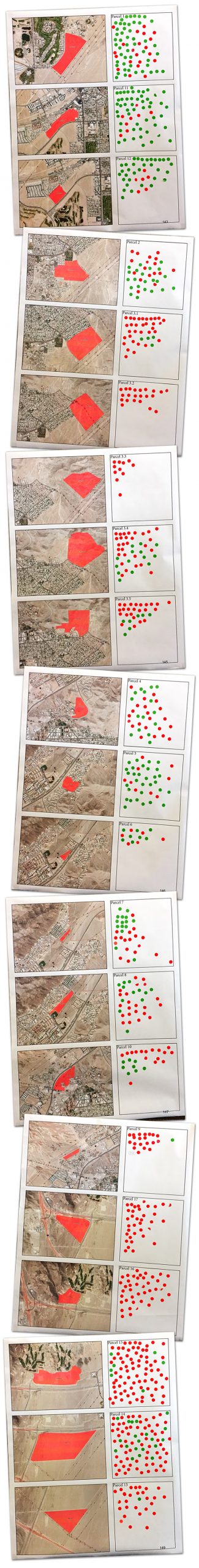
Perhaps you’ve heard of the “Red Dot-Green Dot” meeting that took place back in January, but if not, residents were asked to attend and each were given 3 red dots and 3 green dots so they could prioritize which residential parcels they preferred to see developed (green dots) vs. which ones they preferred NOT to see developed (red dots).
Although the meeting format didn’t go over very well with attendees who wanted to have a discussion and express their opinions verbally rather than be limited to prioritizing parcels with stickers, it did end up being an effective way to indicate (very strongly) to city leadership as to their preferences.
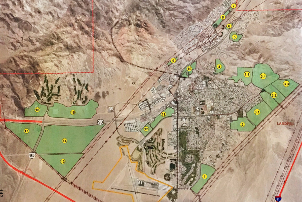
Above is the map that shows which parcels were up for consideration and below are maps with each parcel and its number/color of dots (listed in order of preferred development on top and non-preferred development at the bottom). For those wishing to view a larger size PDF of all maps, you can find that by CLICKING HERE.
As development on the highway coming into town was clearly a ‘non-favorite’ for residential development (bottom maps), the final parcels that will move onto the next phase are Parcels 1 (immediately south of the “B” Hill area adjacent to the Georgia Flood Control Channel) and Parcels 11 and 12 (the old airport site).
It bears noting how often it was expressed by council members that this is the very first stage of the process and it would take more than a handful of years before any actual development would occur in either of these locations.
If you would like to read more about Boulder City’s Land Management process, you can read about how the plan works on the City’s website by CLICKING HERE…